Wednesday, May 18, 2011

Well after a spectacular last couple of days, the air is coming out of our good weather balloon. Today is OK, there are a few sprinkles/light showers in the region, that continue to fall apart in the drier air in the bottom part of the atmosphere, however the changes aloft will start to overwhelm this drier surface air later this evening through lunch tomorrow and we're probably going to see some good soaking rains move into the area and once the rain arrives it may be quite some time before we get 2 straight dry days again as things get much wetter in this part of the country.

The storm that's going to play havoc with is for a couple of days is located in the Western part of the country. It's sitting and spinning around now and will eventually break into a few pieces as it mostly moves towards the NW of here through FRI. What this will do is tonight help to establish a low level jetstream about 5K feet above the ground. This get will be poking right towards us A.M. tonight through daybreak tomorrow. This will result in rising air aloft that will form into t/storms that will move through the area with some locally heavy rainfall. They'll have a tendency to regenerate during the AM tomorrow and continuously move through for a few hours so even tomorrow AM may be wet at times. Typically these things rapidly fade near lunch, of not before and we should dry out for the PM tomorrow afternoon. Highs should be squelched because of this. Probably only in the 60s.

Then Friday will be iffy for a different reason, and it should be noted that there will be plenty of dry hours throughout the next 5 days, so you will be able to do some things outdoors, you'll just have to pick and choose your activities a bit in between bouts of rainfall. The Upper Level Storm will be a bit closer to us, in the Western Plains. This means that the air aloft will continue to support t/storms at times since it will be rising. Also, the atmosphere will be uncapped, so there will be nothing to keep the storms from really forming. There will at times be little disturbances that move our way irritating the airmass that will be warm and humid. So the ingredients are certainly there for additional storms through SAT AM. There may be a break SAT PM-SUN...we'll wait and see about that.

Then another storm will move through the region next TUE...meaning more rainfall, perhaps some severe weather as well.

While random severe weather reports of hail/winds can't be ruled out tonight or FRI...nothing widespread is expected into the weekend. Warm and Humid weather will continue through TUE, before breaking sometime WED perhaps.

Meanwhile folks are starting to buzz about the lack of severe weather this May...it is interesting for sure to see the dramatic differences between last month's records (history setting) achievements and really not much for what is the most active month of the year on average. It will get a bit busier for chasers, there are some nice surface indicators for the folks in the SW Plains states to be alert for for the next couple of days, but at least to me, it seems the next couple of days are isolated type events rather than widespread type things. Next week's storm does look more energetic and potentially more interesting along those lines however. Take a look at the stats through yesterday AM...click to enlarge that image. There were 5 reports yesterday and I believe one today in MD so you can add a few to that May total.


So speaking of April in a way...look at what I just stumbled upon. It's a cool animation of the entire month of April with the Tornado reports as the cyclones moved on through. This is pretty neat!

Have a great rest of the week and I'll see you again on Saturday!

Joe

Thursday, May 12, 2011

From summer to a return of more late fall type weather. We were near 90 for a couple of days...and now highs may struggle to get to 60 or so for a couple of days and another chilly for the season airmass gets ready to move into the area. You can see the chill on the 2PM surface map out to the west...


The chillier air across the western plains will arrive towards tomorrow morning. As a result highs tomorrow with lots of clouds expected are going to be in the 55-60 range and perhaps even chillier in the PM hours with showers in the area. The moisture may have a tough time getting scoured out after it arrives. So while some sun is expected, clouds may be the predominate weather over the weekend and with the chillier air aloft moving through the region, and also at the surface, highs are going to struggle all weekend.

From Monday on next week...the weather may be VERY nice for a few days, perhaps still a bit below average, but MON-THU could be real gems with highs in the 60s/70s and lows in the 40s/50s. At this point no significant rainfall,a side from whatever happens tomorrow is expected for awhile.

Meanwhile for the rest of the day today, our storm chances seem pretty small at this point. Can't rule something out but the higher chances appear to be closer to the surface low. The SPC has issued a Tornado Watch for parts of N KS and S NE for the rest of the afternoon and early evening...


Take a look at the radar loop from the Plains states to get an idea where the storms are going to move...basically they'll be swirling around the upper level low which is spinning across the Plains states. Here is a link to the Radar Loop

Now look at the visible satellite picture with clouds rapidly moving from S>N up the State Line into the metro area....


Along the back end of that cloud cover from Topeka southwards is an area that will need to be watched. There is some weak convergence there and some of our extremely short range models are showing the potential for at least some scattered convection to boil up.

Have a great Friday and I'll update the blog again this weekend.

Joe

Thursday, April 14, 2011

Wanted to get an updated weather blog to you early again this afternoon. I'm heading out to talk to 2nd graders in Shawnee in the next hour so this will be somewhat short and sweet.

It's going to be pretty interesting to watch the weather int he Plains for the next 12 hours or so as a very dynamic storm moves through the western Plains states as I type this. The energy aloft is now translating to an intensifing storm at the surface. Take a look at the 1PM surface map...


The brownish line represents the DRY LINE which has turned into a significant weather player this season as early as it is. Moisture is streaming into the surfae storm in SW KS now. That moisture axis will remain well west of here this afternoon as the storm rpaidly intensifies over the next 6-12 hours. The storms that will develop will initially be firing off near that dry line up towards the Wichita area then move around in a counter clockwise fashion the area of Low Pressure. So the storms will be moving N then NNW then NW around that low. The whole area will gradually spread this way and move in sometime after 8PM I think with the window for T/Storms continuing through 1AM or so. There should be a quick moving line of rain with this and we may get more than 50-75% of of rain totals from this storm from that line of storms. While I'm expecting off/on rainfall tomorrow, the amounts should be under .50", if not under .25". So most of the rain may need to come tonight.

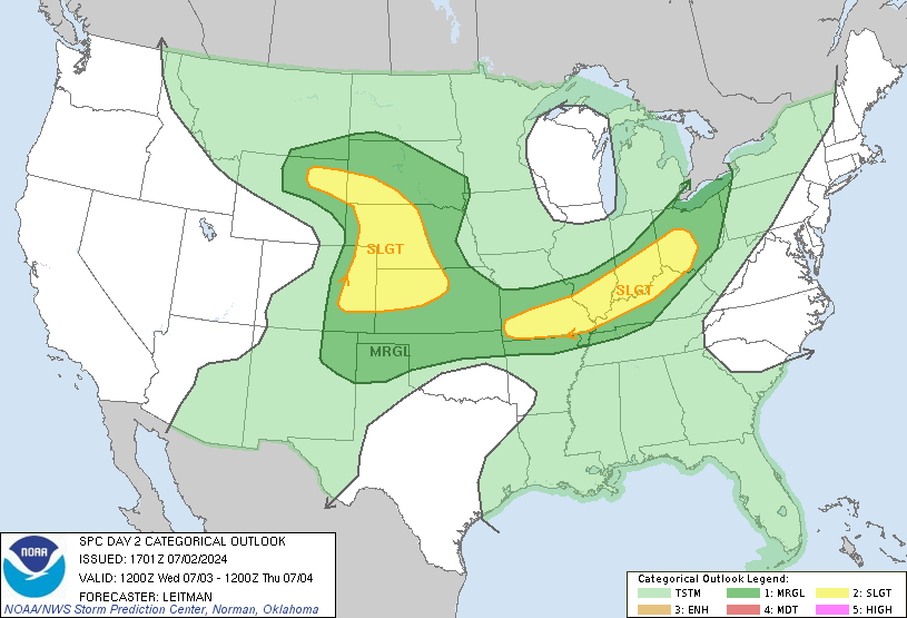
In terms of severe weather, the higher risks look to be S/SW of the metro. The SPC has really not altered their forecast for the last 36 hours. Take a look.


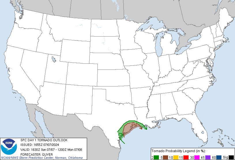
From a tornadic standpoint, the highest risk appears to be in the moderate area that is outline above...


Areas from Garnett to Neodesha to Joplin down into NE OK need to watch this afternoons/evenings developments closely. With the storms moving NNW into drier here here in the metro, they should weaken somewhat as they approach the region. Here is a more thorough update on the areas most prone to nasty weather as the late afternoon/night go along.

All thoughts for tomorrow are the same, chillier with temps int he 50s and off/on showers. Weekend looks OK, chilly SAT AM but between the wind and the clouds, no frost/freeze is expected  in KC and Sunday, while we may see a mid cloud band move on through, highs should recover into the 70s.

I'm still not convinced the modeling has a good grasp on what happens MON night through next WED...the GFS is chillier and wetter on TUE/WED while the EURO is considerably warmer and drier for TUE...we could be in the 50s or the 70s+. The GFS ensembles agree with the operational run and favor a colder wetter solution. That's what I went with, but I'm not convinced it's right. A front will sag to wards the I-70 corridor in that time frame, how far south it gets into the viewing area will determine the 1) amount of rain and 2) the temperatures. This remains to be seen. So use that long ranger with caution.

Finally, more impressive video coming from the state of Wisconsin over the weekend.  Make a look at a tornado on the ground, then lifting then reforming...pretty darn cool!

Joe

Wednesday, April 13, 2011

What an absolutely beautiful afternoon out there. Highs today have been in the 75-80 range and should be mild again tomorrow, although not as mild due to an increase in clouds in the PM hours especially.

A rather dynamic storm is going to organize in the middle part of the country over the next 24-48 hours. The energy for this storm is just now coming into the western part of the country. It really doesn't look like much now actually. Again this will be changing quite a bit over the next 24 hours.

The surface reflection of this energy will really crank up tomorrow. It'll eventually turn into a 995 mb (29.35") or less surface low in Central KS. So for those who "Feel" the effects of pressure changes tomorrow may not be the greatest day for you. As this system cranks up and spins away in the Plains, anotehr impressive dry line will be created to our west and move towards the region. Dewpoints here should increase, although not get out of hand. Right now the moisture, while there, isn't overly impressive towards the southern Gulf Coastal area until you get right to the coastline, but now the flow is off the Gulf of Mexico, so the moisture will start streaming through TX over the next 12 hours. Here is the 1PM surface map showing the moisture well south into TX...


This moisture will be surging northwards tomorrow, and eventually we'll start to see at least 50+ dewpoints move in. The moisture may be a bit more impressive (at the surface at least) to the west of here. From Emporia to Wichita to Concordia, dewpoints should get to near or above 60. With such a dynamic and strengthening storm system, T/Storms should rapidly fire up along and ahead of the dry line that will be pressing eastwards. The storms, because the system is so strong should move to the N/NNE initially as the whole squall line comes together and presses to the east as well. The higher risk, per SPC of severe weather is to the S/SW of the KC region. I can't rule out some hail/wind here tomorrow evening/night however since the storms will be mature as they move into our area. There is also the potential for a fast shot of some heavy rainfall with the storms as the whole line moves through the region. Here is the latest forecast from the SPC...really no different than what we showed you earlier today.


This storm aloft will form into an upper level LOW that should pass right on top or close by to KC on Friday. This means 1) a lot of gray skies 2) off/on chilly showers that will be rotating around the storm 3) the showers may not affect all 4) colder air will spill in with blustery NW winds behind the storm system on Friday night. What's interesting, and perhaps off the radar for some meteorologists, is the potential for even some funnel clouds in Central or Eastern MO on FRI called Cold Air Funnels. this will depend on whether or not the storm ingests dry air into it's circulation, allowing sunshine to break out from the Lakes eastward on FRI...but that too could be an interesting weather day for the Show Me State.

The air behind the storm will be chilly for about 12-24 hours, until the storm pulls away SAT @ Noon or so...then things will moderate and highs should bounce back to the lower 60s on SAT and near 75 on SUN.

Next week will be rainy at times again with up and down temperatures.

Hey before I leave you...I thought this was kind of cool...take a look!

Joe

Thursday, April 7, 2011

Well not exactly the greatest of days in these parts, as a warm front has set up towards the south of the KC area, it's a situation where you have relatively cool east winds at the surface with stronger S winds just above the surface. That creates lift and hence the periods of rain that have moved through the area. There are a couple of weak disturbances that are helping the cause as well. So periods of rain are likely for the next several hours before things try and dry out this evening and overnight.


This warm front will hang around to the south of the region again tomorrow, however the winds aloft above this frontal boundary will be considerably lighter so at this point not a lot of precip is expected tomorrow.

This warm front will lift rapidly northwards SAT AM near daybreak on SAT. Then on SAT we'll be firmly in the warm sector of our next developing storm system in the Rockies. This will, much like last Sunday, allow dewpoints to rise into the 60s and temperatures to soar well into the 80s. However while the moisture will be in place and the instability will be high, the atmosphere should be capped for the day, so aside from perhaps some scattered storms moving through as the warmer air surges in in the early AM SAT, the day looks to be dry, windy and humid here.

Sunday is where things get much more interesting. There are still strong signals that severe weather will be a major issue on Sunday, but there are still questions about who gets pounded. Regardless of the location, one thing is secure, the storm motions will be ridiculously fast, perhaps in the neighborhood of 55-65 MPH on the MO side towards the east of KC. Any downward transfer of the fast movement of the storms, caused by strong winds aloft, easily would create storms capable of 50-70 MPH winds.

The major issue is the timing and location of this development. It seems from the modeling today that the storms would initiate VERY close to KC and then within 1-2 hours be out of our viewing area. That window at this point is between 10AM-3PM. Should the storms fire up on top of us, the higher risk of severe weather would be towards the east of the metro area.

Should the be a 6 hour slower solution, and the storms fire up from Manhattan to Emporia and Wichita, then the metro would be in the thick of things from 4PM-8PM or so.

It's FAR too early to try and get more specific than that. Suffice it to say that there is POTENTIAL for some nasty severe weather, in what is turning into a VERY active 1st part of April for the USA concerning severe thunderstorms.

Chasers that I've talked too, rightfully hate these set-ups, because while the potential is VERY noteworthy, the chasing of said storms is nearly impossible and even if I wasn't working, I wouldn't even bother with this set-up because there is little chance of staying with the storms as they're moving at light speed. You're only hope is to be in the right spot at the right time about 45-90 minutes after the storm is born to see something or to do some limited chasing depending on the road network. Then should this be more of a MO side scenario, that gets to be more problematic as the terrain isn't nearly as flat for observing too many things.

Again lets just wait and observe how things evolve. If your not a fan of severe weather, you want an earlier eruption of the storms when the instability will be less. If this stuff fascinates you you want things to slow down by at least 3-6 hours which is VERY doable considering it's Thursday.

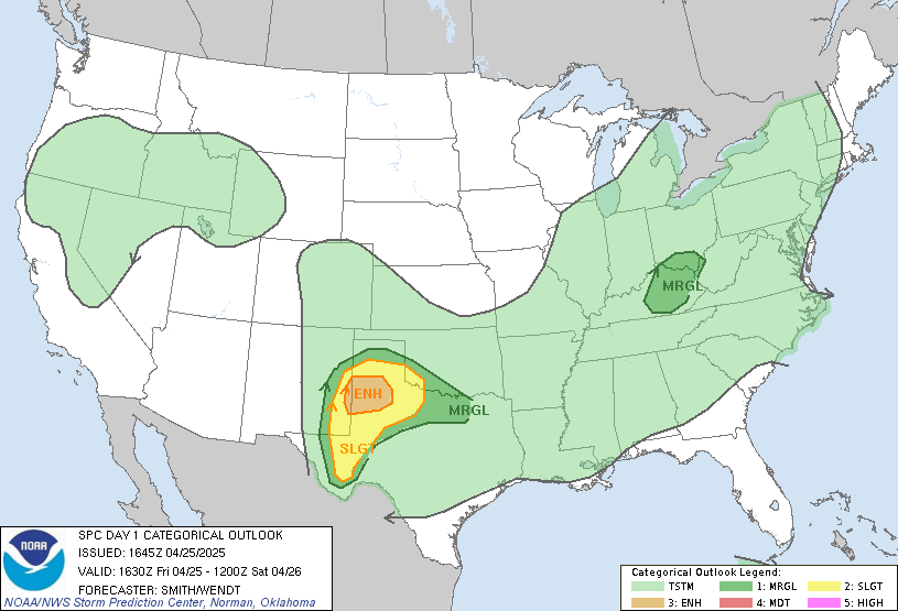
For what's it's worth...here is the SPC forecast issued earlier this AM...


The folks from Colorado State have issued their forecast for the 2011 Hurricane Season, indicating a bigger year for Hurricanes than average. Last year though was very active as well. It's a PDF report, indicating a higher potential, compared to average, of the US Mainland being affected by a major hurricane.

Meanwhile, while moisture from the sky hasn't been to much of an issue here...not too far away, like about 2 states things are pretty dry. As a matter of fact this drought that continues to develop and expand in the southern plains is pretty nasty. Need to watch this because if it's dry there through the rest of the spring and summer and the heat is festering down there, that could easily expand up towards us as the summer evolves...take a look at the latest drought report...

Have a great rest of the day and thanks for stopping by!
 
Joe

Saturday, March 19, 2011

What a crazy day. I participated in the Douglas County Severe Weather Symposium for most of the morning and early afternoon. I presented a talk concerning the research I did a few years ago, about what would happen if the tornados that affected the Greensburg, KS region hit the KC Metro area. Using GIS data I came up with some stunning results.

About 200-250 people were there. I promised them a link to see whether or not the modified tornado tracks that occurred would've been in your neighborhood. Take a look at the data

As all this was being juggled, we then had a Severe T/Storm Watch issued for a few of our far southern counties, and then even a couple of warnings for the metro. This sent the various Emergency Managers scrambling to their work duties. I was at the same time talking our folks through a computer reboot for our symbol that was on the bottom of the screen during the T/storms. For the most part...it looks like the hail that did fall in a few areas was generally quarter sized or less. Although farther to the SW, golfball sized hail was reported near Cottonwood Falls, KS (near Emporia). Anyway a crazy weather/job wise day today. Rainfall was pretty moderate and persistent for a few hours. Rainfall amounts were generally in the .10-.50" range with perhaps a couple of higher isolated totals. KCI has had .45" through 7PM with some additional rain on the way, although not to the extent of those later AM and PM totals so far today.

We are going to surge into the warmer air tomorrow AM I think. The warm front is now down towards the Red River area...


It should rapidly be moving northwards towards daybreak tomorrow and zip through the region placing our area firmly in the warm sector tomorrow through Tuesday. One fly in the ointment for Monday is whether or not the warm front which will move north of the area tomorrow, sags back towards N MO Monday as a surface low tries and turns the winds in part of the area more towards the east. This developing area of Low Pressure will intensify Tuesday through the plains and then force the warm air back northwards again. There is a bust potential to the temperatures on Monday.

Regardless we should be back in the warmer & more humid airmass on Tuesday, with dewpoints in the 55-60 range expected. With a Low in the plains and a cold front moving into the area just after peak heating, and whatever cap that builds in eroding, the potential is there for storms and potentially some severe weather. Lots of questions as is typical of March set-ups, including the amount of instability that will be in place and where the initiation of the storms will take place. I do want you to track the unfolding scenarios with Tuesdays potential however because it does look somewhat promising for our first severe weather outbreak closer to home, especially later TUE PM into the overnight.

After that storm moves through a gradual cooldown takes place as highs may struggle to reach 50 towards the end of the week.

Joe

Saturday, March 12, 2011

All of a sudden a simple weekend has gotten a bit more complicated.

Don't forget to set your clocks FORWARD one hour tonight as Daylight Saving Time starts officially @ 2AM Sunday morning.

Our weather yesterday sprung towards Spring...today very seasonable for mid-March and tomorrow we may return to some late FEB type weather as clouds will quickly be on the increase and gradually lower and thicken as the day progresses. I think MOST of the daytime is dry but some light showers may develop later tomorrow PM and then expand to a general light rain tomorrow night. This is where it may get complicated, because while temperatures at the surface and up through 5000 feet will initially be way too warm for any snowflakes to make it down to the ground, there is going to be a dry layer of air below the cloud deck and as whatever falls through that column of dry air, it'll evaporate and that process will tend to chill that column of air, enough that perhaps some sort of wintry mix or sleet/flakes can be created. The 18Z NAM and GFS were both reasonably bullish with the amount of precip...take a look at the 18Z runs for total liquid precip...


1st the NAM model valid through 1PM Monday...


Now the GFS model valid through 1PM Monday


So the precip is there...what about the critical temperatures of the column of air aloft...1st let me show you the FORECASTED sounding from 3PM tomorrow off the NAM...


The area that is highlighted, below 840 mbs...or 5000 feet or so is, in some cases as warm as 42 degrees aloft. Notice the left side side (dewpoints) showing dry air. The more spread between the 2 lines the drier the air is. Now notice what happens towards midnight..


The atmosphere is saturated and the column has cooled through evaporation. So it's possible that whatever falls at first is rain then we could see some sort of mixture of rain/sleet then perhaps some flakes will mix in, although even farther up the creation of snowflakes in the clouds may be tough to come by based on this information although the process is going to be easier to create flakes later into the evening.

The wave itself is not that impressive, but perhaps stronger than the models think...is located out towards the Rockies...


Well the 0Z NAM is out...and knocks us with a snowstorm tomorrow night into MON AM (3-6")...I'm not going to jump head first into this yet...but the trends today are certainly snowier...

Joe